Category:East Harling
Jump to navigation
Jump to search
English: East Harling is a village in the English county of Norfolk. The village forms the principal settlement in the civil parish of Harling, and is located some 8 miles (13 km) east of the town of Thetford and 25 miles (40 km) south-west of the city of Norwich.
village in Norfolk, UK  | |||||
| Upload media | |||||
| Instance of |
| ||||
|---|---|---|---|---|---|
| Location | Harling, Breckland, Norfolk, East of England, England | ||||
 | |||||
Subcategories
This category has the following 5 subcategories, out of 5 total.
Media in category "East Harling"
The following 31 files are in this category, out of 31 total.
-
 Bridleway to Hill Harling - geograph.org.uk - 355249.jpg 640 × 427; 67 KB
-
 Church Road - geograph.org.uk - 1019541.jpg 3,072 × 2,304; 1.5 MB
-

-
 East Harling - geograph.org.uk - 32241.jpg 640 × 431; 224 KB
-
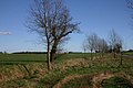
 East Harling Common - geograph.org.uk - 832242.jpg 640 × 427; 83 KB
-
 East Harling fire station - geograph.org.uk - 1395102.jpg 640 × 426; 200 KB
-
 East Harling Recreation Club - geograph.org.uk - 1019498.jpg 3,072 × 2,304; 1.27 MB
-
 East Harling tower windmill (geograph 2250026).jpg 640 × 603; 189 KB
-
 Garboldisham Road (B1111) - geograph.org.uk - 223153.jpg 640 × 480; 89 KB
-
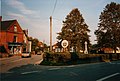
 Harling Village Sign - geograph.org.uk - 1019594.jpg 3,072 × 2,304; 1.44 MB
-
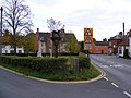 Harling village sign 1019588.jpg 3,072 × 2,304; 1.35 MB
-
 Ordnance Survey Drawings - East Harling (OSD 291).jpg 4,000 × 2,309; 2.34 MB
-

-

-

-

-
 The main village of East Harling - geograph.org.uk - 358350.jpg 640 × 442; 75 KB
-
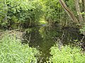
 Algae-covered pond - geograph.org.uk - 832226.jpg 640 × 427; 124 KB
-
 Algae-covered pond - geograph.org.uk - 832235.jpg 427 × 640; 140 KB
-
 Bridleway to Flint Hall Farm - geograph.org.uk - 355254.jpg 640 × 427; 75 KB
-
 Cottages on the fringe of East Harling - geograph.org.uk - 223178.jpg 640 × 480; 121 KB
-
 East Harling - geograph.org.uk - 32242.jpg 640 × 462; 228 KB
-
 East Harling cemetery - geograph.org.uk - 354025.jpg 640 × 427; 67 KB
-
 Impassable footpath - geograph.org.uk - 456058.jpg 640 × 477; 154 KB
-
 Market Street, East Harling (B1111) - geograph.org.uk - 358355.jpg 640 × 442; 78 KB
-
 Pig farm near East Harling - geograph.org.uk - 355251.jpg 640 × 427; 43 KB
-
 Plantation near East Harling - geograph.org.uk - 223149.jpg 640 × 480; 133 KB
-
 Roadside verge near Guilt Cross - geograph.org.uk - 355256.jpg 640 × 427; 72 KB
-
 Towards Woodlands - geograph.org.uk - 379411.jpg 640 × 480; 82 KB
-
 Track to Langskys - geograph.org.uk - 354016.jpg 640 × 427; 95 KB
-
 West Harling Road, East Harling - geograph.org.uk - 223169.jpg 640 × 480; 90 KB


_from_the_air_-_geograph.org.uk_-_358346.jpg)


.jpg)
_-_geograph.org.uk_-_223153.jpg)

.jpg)
.jpg)
.jpg)
.jpg)


_-_geograph.org.uk_-_358355.jpg)


